- Share
ACES KSA Survey department is happy to announce the introduction of Mobile Mapping System (MMS) technology into its existing service portfolio.
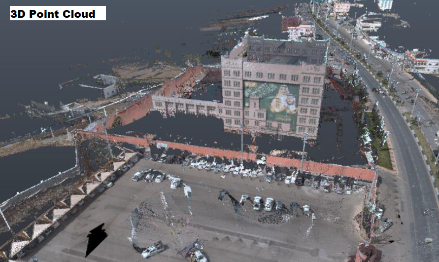
The MMS data acquisition system is a Light Detection and Ranging (LIDAR) survey instrument that integrates data from several devices, including Global Positioning System (GPS), IMUs (Internal Measurement Unit), laser scanners, and spherical cameras into one system. MMS can capture 1 Mn point per second along with high-resolution panoramic photos, which create accurate 3D point cloud and georeferenced panoramic images for the surveyed elements. MMS data is collected for cadastral surveys, GIS applications, topographic surveys, among others.
ACES KSA has recently completed three projects using MMS technology, including the survey of:
- Commercial Building - Salboukh (Client: Engineering Consultants Group): ACES delivered a comprehensive topographical map assisting in the design of commercial and residential buildings within the project area (2,000,000 m2)
- Assir-Albaha 193 km2 flood plain (Client: DAR Al-Handasah): ACES delivered the survey to assist in hydrological studies for the flood plain, flood inundation, and flood risk assessment
- Amala Airport (Client: Rawabi BUTEC): ACES delivered the topographic survey of future airport stands.